
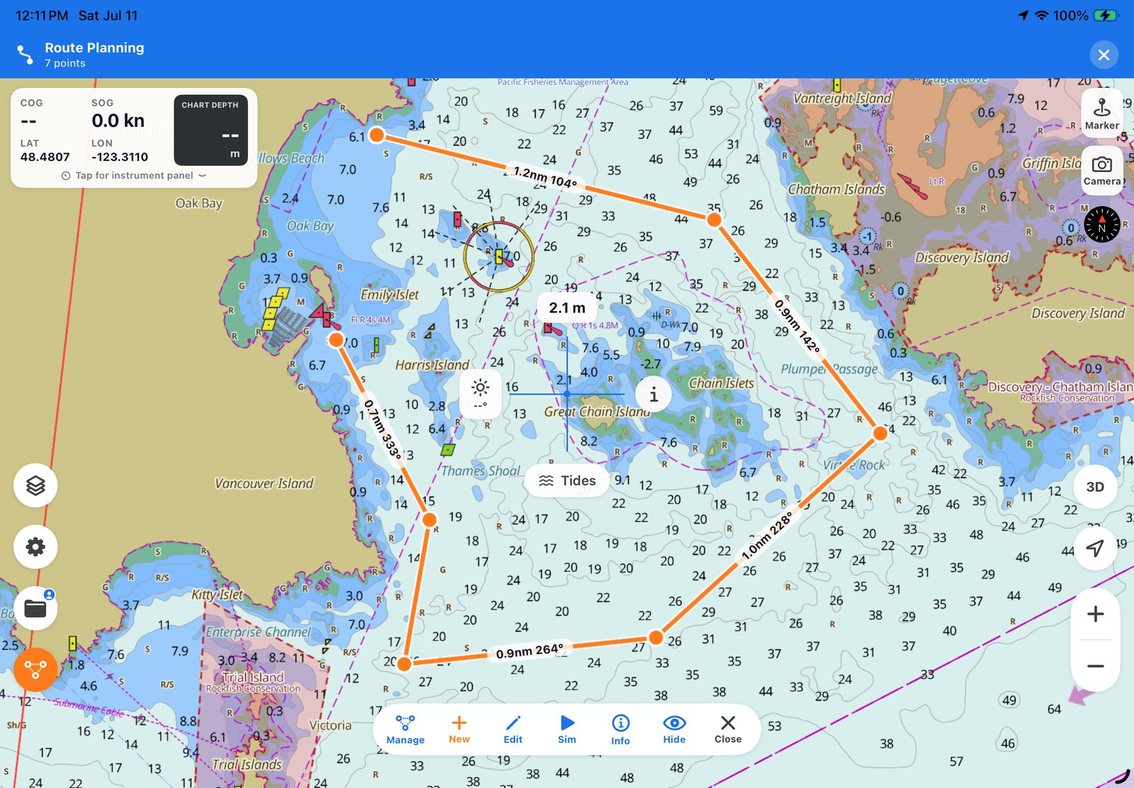
Some of the most useful knowledge on the water never makes it into a notebook. It is the turn that gave you a comfortable approach to the anchorage, the side of the channel that carried the best water, or the real time it took to cross the bay in an afternoon breeze.
SeaVectors lets you keep that knowledge without interrupting the trip. Start a track as you leave, and the app draws your boat’s actual path on the ENC chart while recording distance and time. Stop it when you arrive, give it a useful name, and the passage becomes part of your own navigation history.
Your real trip, recorded automatically
A route shows where you intend to go. A track shows where you actually went.
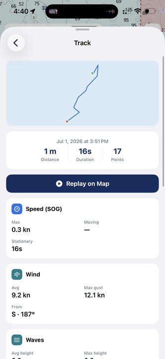
While recording, SeaVectors follows your course over ground and builds a clear line behind the boat. When the trip is complete, the saved track keeps its shape, distance, duration, point count, and color. A visual preview makes it easy to recognize later—even after a full season of weekends on the water.
That means no guessing when you want to remember a passage. You can see where you altered course, how far you travelled, and how long the trip really took. It is an automatic logbook entry created while you focus on navigating.
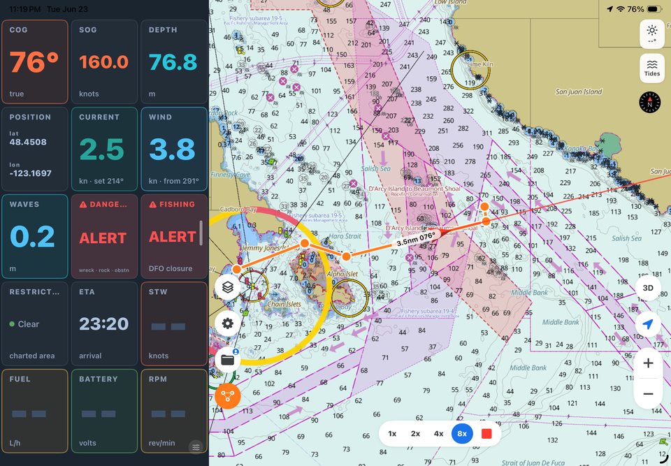
Start in seconds
Recording a useful track does not need to become another job at the helm:
- Open SeaVectors before departure and start track recording.
- Navigate normally while the app records your movement in the background.
- Stop and name the track after you are safely secured.
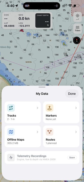
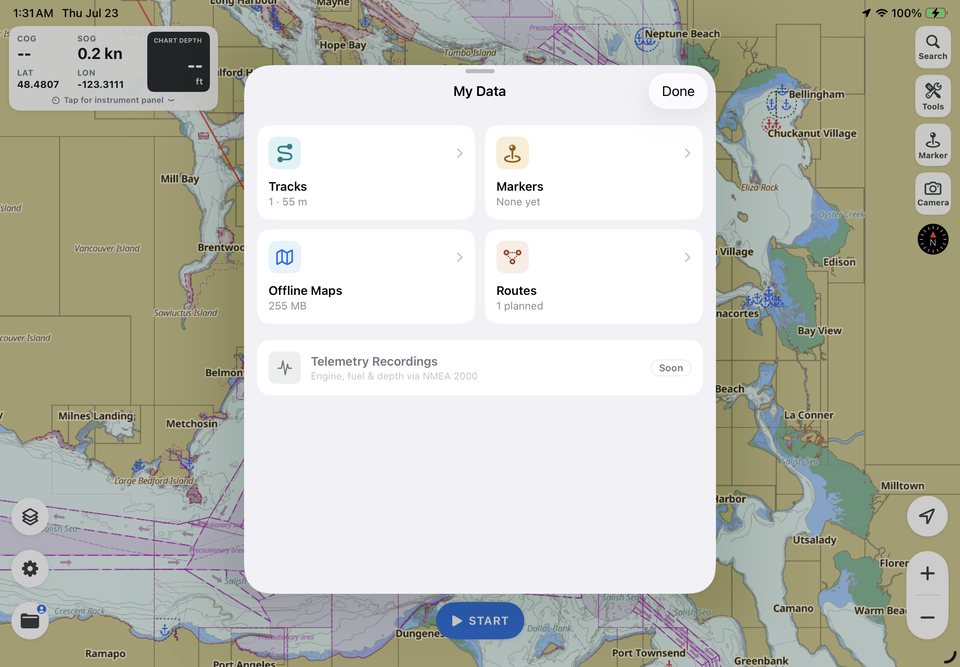
Your saved tracks live in My Data, ready to review or display on the chart. Choose distinct colors for trips in the same area, and use names you will recognize later—such as “Bedwell Harbour entrance — rising tide” rather than “Track 12.” A small amount of context today makes the record much more valuable next season.
Useful context for the way back
Tracks are especially helpful around an unfamiliar anchorage, a winding inlet, or a harbor entrance with several turns. Before leaving, you can review the line from your arrival and recall where you slowed down, changed course, or found a comfortable approach.
That familiar line can reduce uncertainty, but it is not an autopilot route or a guarantee of safe water. Tide, depth, current, weather, visibility, traffic, and local restrictions may have changed, and every position source has limits. Use a previous track as one source of context alongside the latest ENC chart, present conditions, depth information, and a proper lookout. If anything has changed, plan a new path.
Used that way, a track does something genuinely valuable: it brings your own recent experience back onto the chart without asking you to rely on memory alone.
Build a logbook you will actually keep
Because recording takes so little effort, tracks can become a habit. A short fishing trip, a weekend cruise, a first visit to a new marina, or a passage worth remembering all become searchable records with real distance and time.
Sign in to SeaVectors and your saved data can stay connected to your account, making it easier to keep your navigation history when you change devices. Add markers, photos, and notes, and My Data grows into a personal layer of experience over the official chart: places you enjoyed, approaches you learned, and trips you want to make again.
Learn from every passage
A saved track is useful after the lines are ashore, too. Compare it with the route you planned. Did wind or current push you away from the intended line? Did one leg take longer than expected? Was there a turn you would position differently next time?
A two-minute review can improve the next fuel estimate, departure time, and route plan. Over time, your tracks become more than a collection of colored lines. They become a practical record of how your boat moves through the waters you use most.
SeaVectors combines official ENC charts, routes, weather, instruments, markers, and your recorded tracks in one place. You can plan the trip, navigate it, and keep what you learned—all on the same chart.
Choose the SeaVectors experience that fits the device in front of you:
- Download SeaVectors for iPhone and iPad and start your 30-day full-access trial.
- Get SeaVectors for Android for navigation on your Android phone or tablet.
- Open the lightweight SeaVectors Web chart for quick chart access from a browser—no installation required.
For track recording on your next trip, open the mobile app before you cast off and see how useful one simple habit becomes. For the complete walkthrough, continue with Recording & Managing Tracks, Markers, Photos & Notes, and the My Data Hub.