
The best days on the water start the night before. Not with the engine, but with the chart — a quiet half hour working out where you're actually going, which way you'll come at that headland, and whether there's enough water at the time you'll arrive.
Most of us do a version of this in our heads. We picture the route, guess the timing, and sort out the details underway. It usually works. But "usually" is doing a lot of work in that sentence, and the places it fails — a leg that clips a shoal at low water, a turn that puts you inside a restricted zone, an ETA that lands you at the bar on the ebb — are exactly the places you'd want to have caught at the dock.
SeaVectors is built to catch them. You plan the passage on an official ENC chart, and then you do the one thing a paper chart and a mental picture can't offer: you run it. The app drives your boat along the route, leg by leg, so you watch the whole trip play out before you've untied a line.
Try planning a passage you already know, then run the simulation before leaving the dock. The 30-day free trial includes the complete experience, so you can evaluate SeaVectors with your own routes before deciding whether to subscribe.
- Download SeaVectors on the App Store
- Get SeaVectors on Google Play
- Not ready to install? Open the lightweight web chart for a quick preview.
A route is a plan you can actually see
Building a route in SeaVectors is as direct as it sounds. You tap along the chart, and each tap drops a waypoint and draws a leg. A harbor exit, a dogleg around a point, a straight shot across the bay — the line grows under your finger.
What makes it a plan rather than a doodle is what appears as you build. Every leg shows its distance and bearing. The route shows its total distance, an ETA, and an estimated fuel burn — all at the speed you tell it you'll cruise. Change the speed and the whole picture updates: the arrival slides earlier or later, the fuel figure moves with it. That's the number that tells you whether "we'll be in by dinner" is a fact or a hope.
Image: the route mid‑build, per‑leg distance labels and the total distance / ETA / fuel readout visible. Caption: "Distance, ETA, and fuel update live as you plan — at your speed."
If a leg looks tight, you fix it right there. Drag a waypoint to move it, add one to bend around a hazard, remove one to straighten a run. With the depth and hazard layers on, you can see exactly what you're steering clear of while you do it.
Then you run it — from the dock
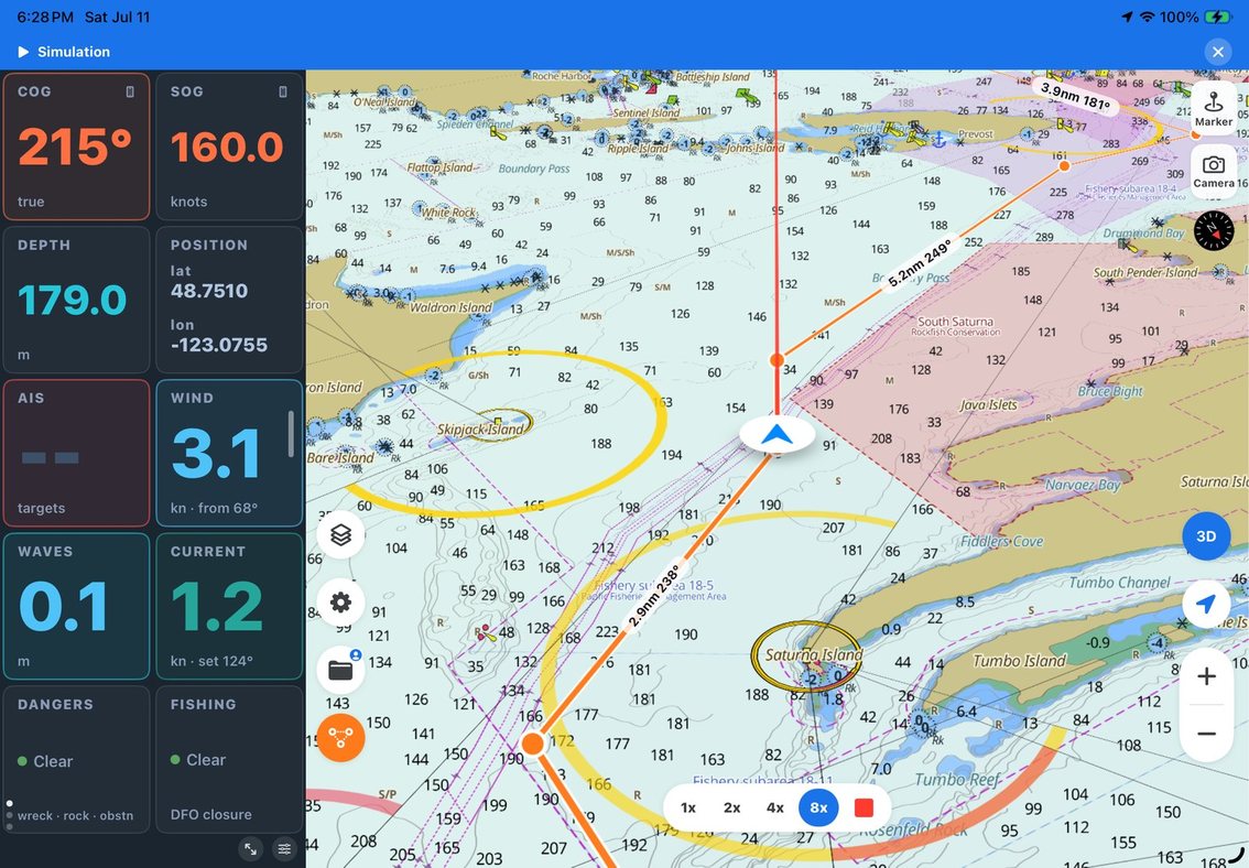
This is the part that changes how you plan. Open the route, start the simulation, and SeaVectors takes the helm of a virtual version of your boat. The icon starts moving down the first leg. Course over ground, speed, position, charted depth — they all come alive on the nav bar and the instrument panel, exactly as they would if you were out there.
You're not reading a plan anymore. You're watching it happen, sped up, in the safety of your slip. And that's when the quiet problems surface. The leg you drew across the bay passes closer to that charted rock than it looked. The turn at the headland clips the corner of a restricted area. Your ETA at the narrows lands you there against the tide. None of these announce themselves on a static chart; all of them are obvious the moment you see the boat move through them.
Image: simulation running — the vessel partway along the route, instrument panel showing live COG/SOG/depth and a counting‑down ETA. Caption: "Simulation drives your boat along the track, feeding the instruments just like a real passage."
When you're done, you stop the simulation and control hands straight back to your real GPS position. Nothing to undo, nothing left running. You've flown the passage once already, and the real one holds no surprises you didn't choose.
Save it, reverse it, reuse it
A good route is worth keeping. Save it with a name and it's there for next time. And because most trips are round trips, SeaVectors will reverse a route end‑for‑end in a single tap — your carefully planned way out becomes your way home without replanning a thing.
Over a season these add up. Your saved routes become a personal library of the passages that worked, each one already validated, each one ready to reverse, adjust, or simulate again when conditions change.
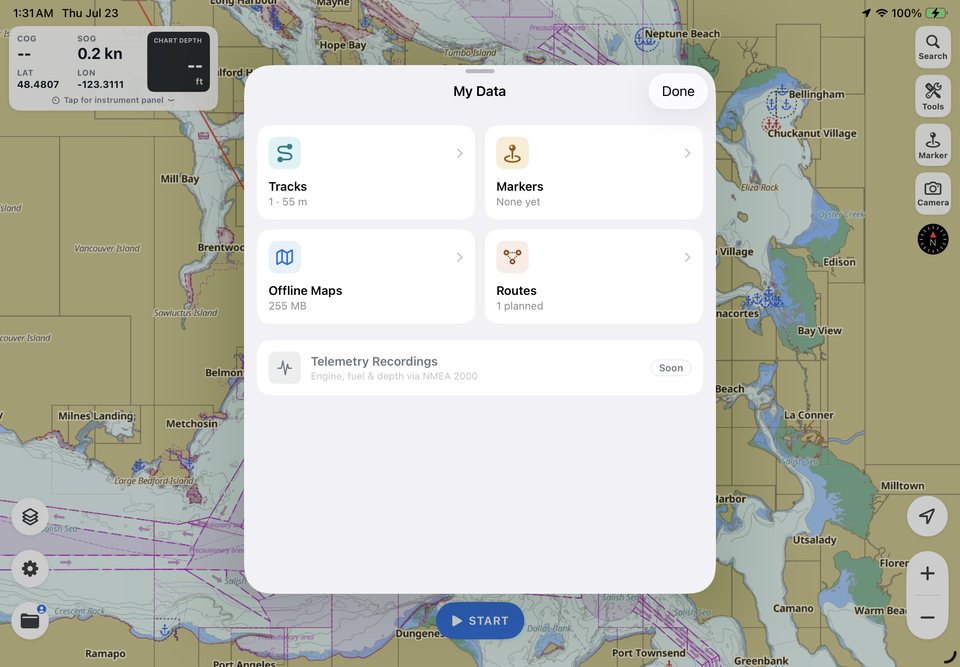
Image: the saved‑routes list in the My Data hub. Caption: "Saved routes live in My Data — reverse, edit, or re‑simulate anytime."
Why it matters
Planning has always been the cheapest safety you can buy. It costs a half hour at the dock and pays off in the one moment underway when you already know the answer instead of working it out under pressure.
SeaVectors makes that half hour count for more. You're planning on official NOAA ENC charts — full US coverage, plus high‑definition vector charts for the Canada West Coast — drawn to the same S‑52 standard used on commercial bridges. The route you build sits on authoritative data, and the simulation lets you prove it against your own boat's speed and draft before you rely on it.
That's the whole idea behind SeaVectors: professional‑grade charts, real conditions, and your boat's own data, in one app you can hold in your hand. Route planning and simulation are where it all comes together — the plan, the chart, and the boat, rehearsed once so the real thing goes right.
Start your 30‑day free trial on the App Store, and plan your next passage before you leave the dock. New to SeaVectors? Begin with our , or go deeper on this feature in .